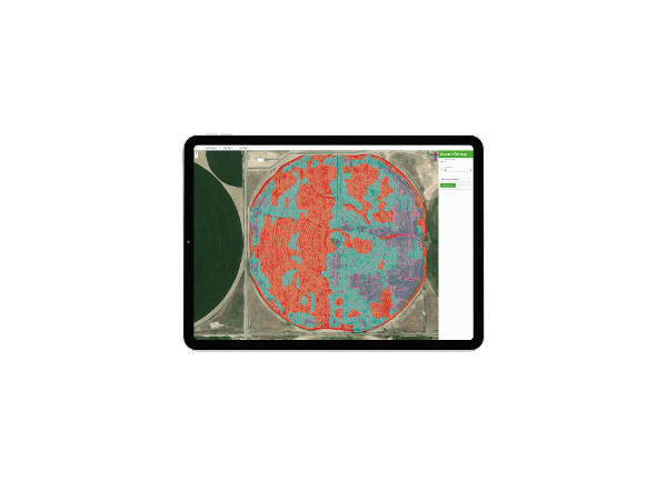
Variable Rate Application tool
As the costs of key inputs rise, many growers are adopting Variable Rate Application (VRA) strategies to minimize expenses without compromising yields. Ceres Imaging offers a built-in tool to generate customized VRA zones from aerial data at the click of a button.
Common uses
-
Reducing input costs—for example, of fertilizer or fungicide
-
Saving time on creating and verifying VRA zones, especially on large operations
-
As an alternative approach to soil mapping—more detailed than SSURGO options, more affordable than EC testing
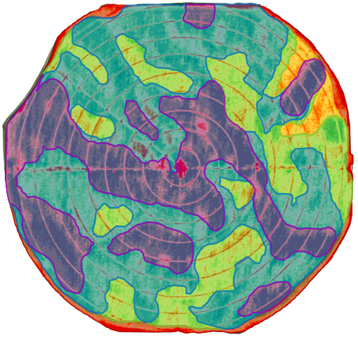
How it works
An effective VRA strategy depends on a zone map that accurately reflects real-world conditions and variability in the field. Ceres Imaging's VRA tool allows growers to create management zones from aerial imagery layers—such as high-resolution thermal and chlorophyll data. Choose from as few as two to as many as 25 zones per field, then import zones directly into your applicator technology.
Ensuring accuracy
Ceres Imaging’s emphasis on quality begins even before we fly your fields.
Image capture
We capture imagery during peak daylight hours and under weather conditions that minimize distortion from shadows and cloud cover. Our highly sensitive, custom-built cameras detect minute changes in the multispectral range—allowing us to detect crop stress earlier than our competitors.
Processing and analysis
Imagery is geo-referenced and meticulously “masked” to ensure that only relevant information is evaluated. By making use of crop-specific data models and isolating the canopy from ground cover and other background noise, we prevent skewing of the data and enable a more accurate assessment of plant health.
Quality control
Imagery is assessed in-house by Ceres Imaging’s remote sensing experts, passing through multiple checkpoints before delivery in the Ceres Imaging app within 48 hours of the flight. Growers can access their data on a mobile device, tablet, or desktop computer.
More imagery and analytics
![]()
Get started with Ceres
Schedule a consultation for detailed product info, pricing, and more.

The difference between Ceres AI and other technologies I've used is the help I get from their expert team.
With Ceres AI we can take a more targeted approach to applying fertilizer and nutrients.
These flights can cover way more ground and provide more insight than a dozen soil moisture probes — and it's cheaper to implement.
The average Ceres AI conductance measurement from its imagery over the season has provided the best correlation with applied water.