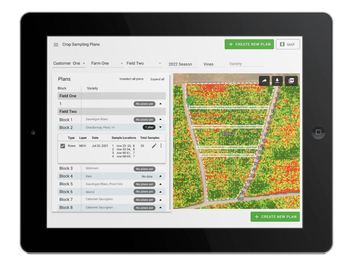
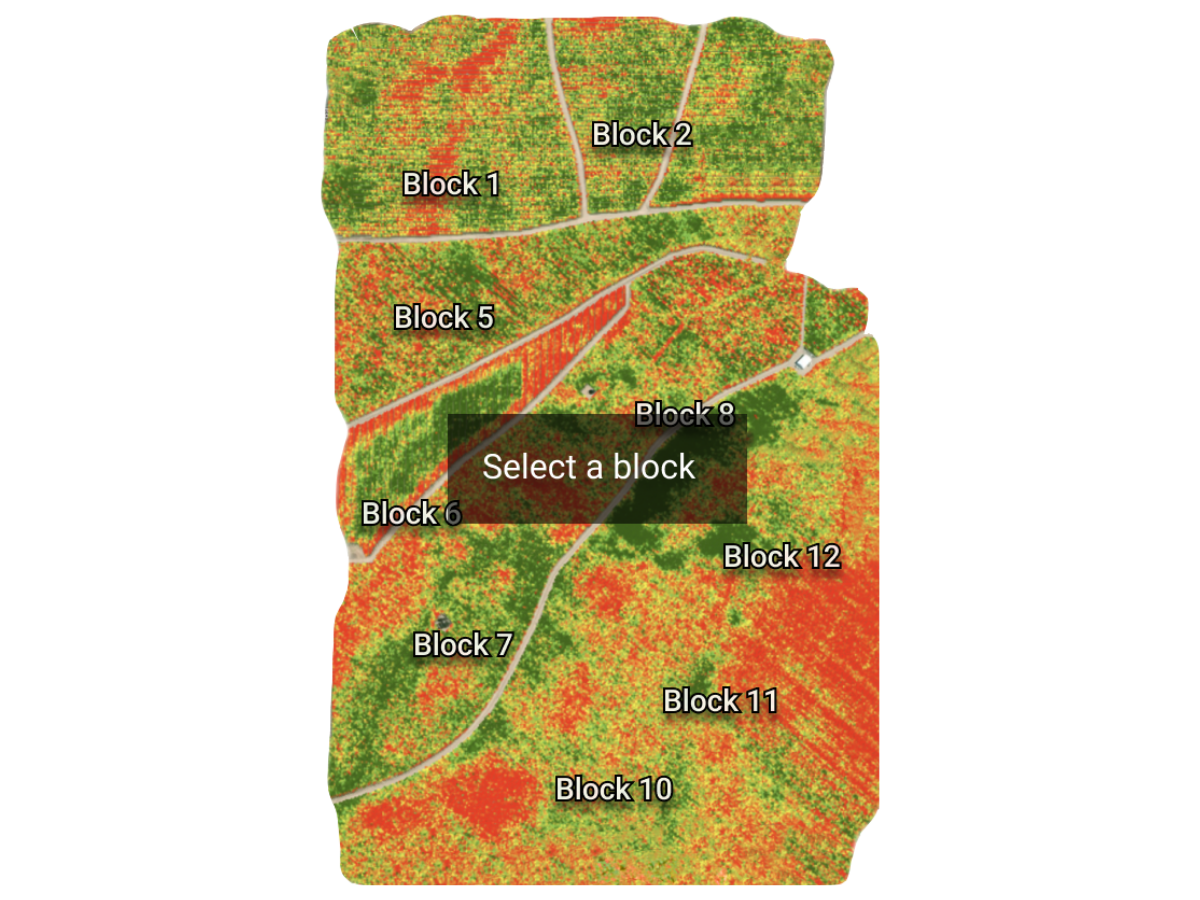
Targeted sampling
Accurate yield estimation is simpler and more efficient with sampling recommendations from Ceres Imaging. Our targeted sampling tool uses your aerial data to identify the best locations for sampling and the most streamlined approach to collecting measurements—saving you time and preventing costly errors.
Common uses
Targeted sampling is available to vineyard customers for:
-
Accounting for variability in yield estimates
-
Reducing time and expense of sample collection
-
Improving accuracy vs. random sampling
How it works
To estimate yields with a high degree of confidence, many growers invest significant time and labor in extensive sampling, re-sampling, and calculations.
Now, Ceres Imaging offers a more efficient alternative that streamlines the process of yield estimation without sacrificing accuracy. The targeted sampling tool uses precise aerial measurements of canopy growth to assess variability and recommend the sampling locations most likely to be statistically representative of the field as a whole.
Having a clear and exact plan for sampling minimizes the potential for human error—and the time and expense of correcting mistakes.
Ensuring accuracy
Ceres Imaging’s emphasis on quality begins even before we fly your fields.
Image capture
We capture imagery during peak daylight hours and under weather conditions that minimize distortion from shadows and cloud cover. Our highly sensitive, custom-built cameras detect minute changes in the multispectral range—allowing us to detect crop stress earlier than our competitors.
Processing and analysis
Imagery is geo-referenced and meticulously “masked” to ensure that only relevant information is evaluated. By making use of crop-specific data models and isolating the canopy from ground cover and other background noise, we prevent skewing of the data and enable a more accurate assessment of plant health.
Quality control
Imagery is assessed in-house by Ceres Imaging’s remote sensing experts, passing through multiple checkpoints before delivery in the Ceres Imaging app within 48 hours of the flight. Growers can access their data on a mobile device, tablet, or desktop computer.
More imagery and analytics
The difference between Ceres AI and other technologies I've used is the help I get from their expert team.
With Ceres AI we can take a more targeted approach to applying fertilizer and nutrients.
These flights can cover way more ground and provide more insight than a dozen soil moisture probes — and it's cheaper to implement.
The average Ceres AI conductance measurement from its imagery over the season has provided the best correlation with applied water.