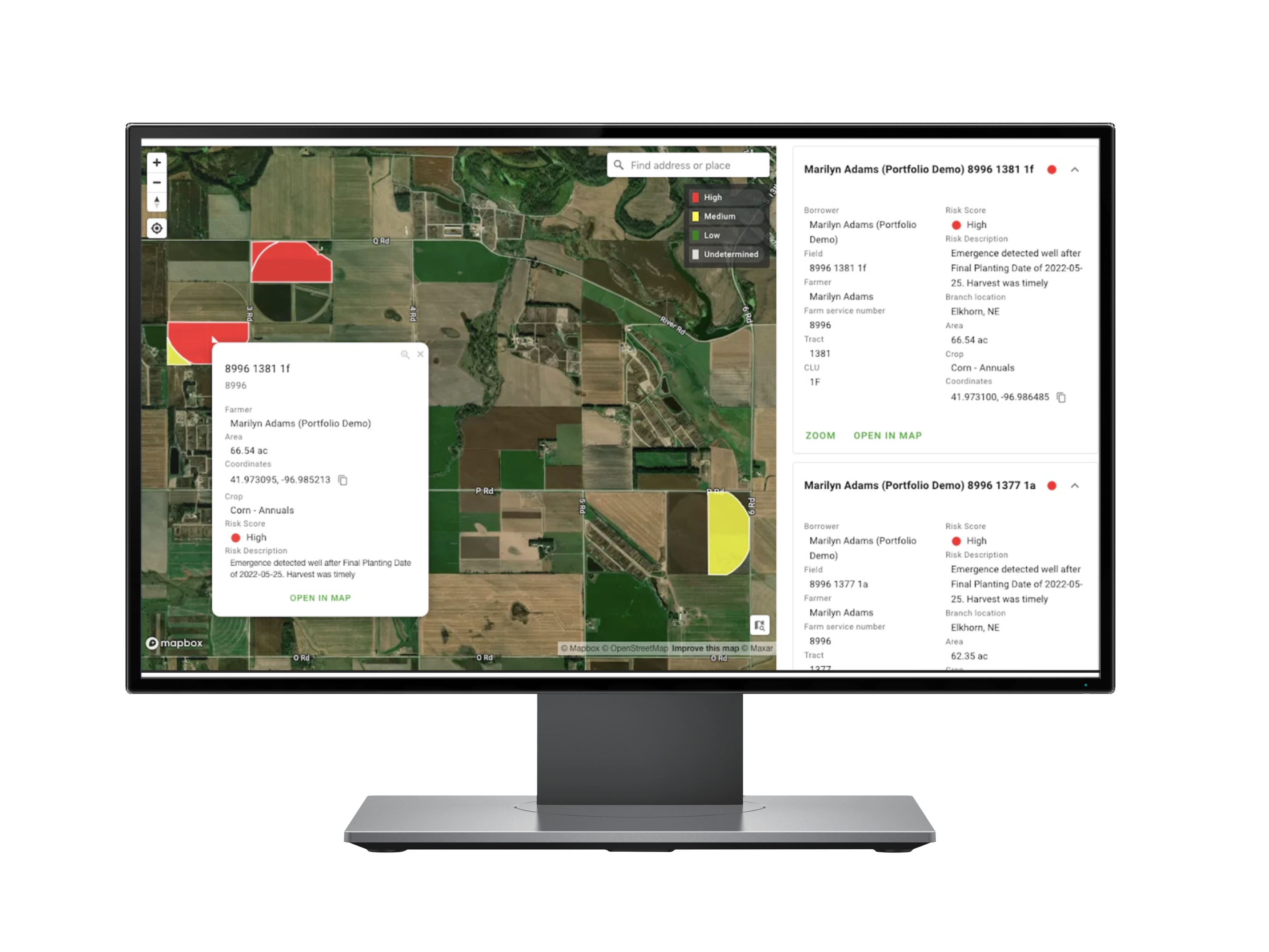
Portfolio insights
From insurers and lenders to global manufacturers, many businesses manage increasingly complex and distributed agricultural assets. Whether your work spans counties or continents, portfolio insights from Ceres AI provides a visually intuitive monitoring solution customized with metrics that matter to you.

Common uses
-
Understanding large, geographically distributed portfolios at a glance
-
Ranking and prioritizing issues for follow-up
-
Identifying high-risk fields in time for intervention

How it works
Ceres analyzes and combines satellite and high-resolution aerial data from individual farm fields into a single, easy-to-navigate map. Instead of assessing results one asset at a time, all monitored fields within the portfolio are viewable, searchable, and sortable according to your chosen metrics—from level of risk, to crop health and uniformity.
From within the Ceres app, it’s easy to toggle between a bird’s-eye-view of the full portfolio to in-depth detail on a single asset. Because Ceres’ technology can detect milestone events including planting, emergence, and harvest—as well as specific management practices such as tillage or use of cover crops—it’s a powerful and time-saving tool for monitoring and reporting on progress across a portfolio.
Ensuring accuracy
Ceres AI's emphasis on quality begins even before we fly your fields.
Image capture
We capture imagery during peak daylight hours and under weather conditions that minimize distortion from shadows and cloud cover. Our highly sensitive, custom-built cameras detect minute changes in the multispectral range—allowing us to detect crop stress earlier than our competitors.
Processing and analysis
Imagery is geo-referenced and meticulously “masked” to ensure that only relevant information is evaluated. By making use of crop-specific data models and isolating the canopy from ground cover and other background noise, we prevent skewing of the data and enable a more accurate assessment of plant health.
Quality control
Imagery is assessed in-house by Ceres Imaging’s remote sensing experts, passing through multiple checkpoints before delivery in the Ceres Imaging app within 48 hours of the flight. Growers can access their data on a mobile device, tablet, or desktop computer.
More imagery and analytics
The difference between Ceres AI and other technologies I've used is the help I get from their expert team.
With Ceres AI we can take a more targeted approach to applying fertilizer and nutrients.
These flights can cover way more ground and provide more insight than a dozen soil moisture probes — and it's cheaper to implement.
The average Ceres AI conductance measurement from its imagery over the season has provided the best correlation with applied water.