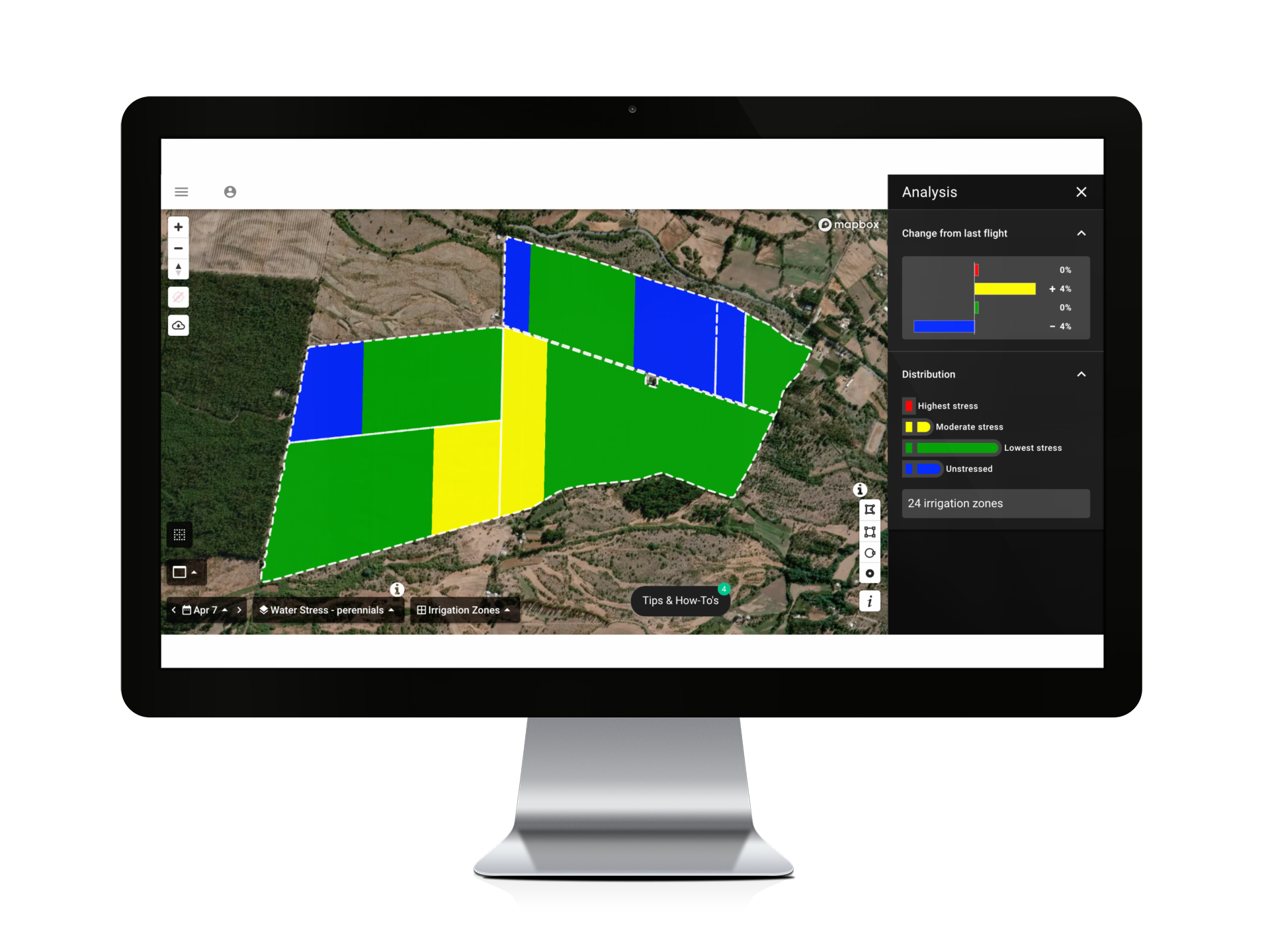
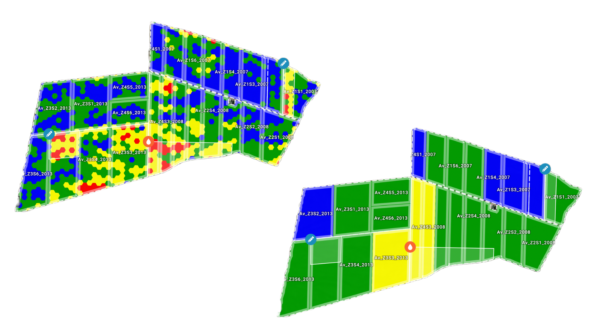
Custom zones
For busy operations, access to crop health data isn’t enough: you need insights at a glance. Whether your team plans by the acre, field, or other management zone, Ceres Imaging offers intuitive analytics tools to match—switching seamlessly from plant-level detail to big-picture strategy whenever you do.

Common uses
-
Tracking crop health across large, distributed operations
-
Prioritizing limited resources—for example, ranking fields or irrigation zones by level of water stress
-
Evaluating impact of farm management decisions over time

How it works
Ceres Imaging uses industry-leading technology to capture and analyze crop health data. Our level of precision—down to the individual plant—means our customers can easily quantify and track changes in crop health.
Custom zones take these powerful analytics tools a step further, aggregating crop health data into meaningful units for key farm management decisions. Custom zones are tailored to your business needs and instantly responsive: start with a view by irrigation zone to guide scheduling adjustments, then switch to individual blocks to set scouting priorities.

Customized views
Crop health data at the individual plant level unlocks the ability to customize your view to the task at hand. Pinpoint missing trees, assess crop stress by irrigation zone, or compare performance between varietals.
Ensuring accuracy
Ceres Imaging’s emphasis on quality begins even before we fly your fields.
Image capture
We capture imagery during peak daylight hours and under weather conditions that minimize distortion from shadows and cloud cover. Our highly sensitive, custom-built cameras detect minute changes in the multispectral range—allowing us to detect crop stress earlier than our competitors.
Processing and analysis
Imagery is geo-referenced and meticulously “masked” to ensure that only relevant information is evaluated. By making use of crop-specific data models and isolating the canopy from ground cover and other background noise, we prevent skewing of the data and enable a more accurate assessment of plant health.
Quality control
Imagery is assessed in-house by Ceres Imaging’s remote sensing experts, passing through multiple checkpoints before delivery in the Ceres Imaging app within 48 hours of the flight. Growers can access their data on a mobile device, tablet, or desktop computer.
More imagery and analytics
The difference between Ceres AI and other technologies I've used is the help I get from their expert team.
With Ceres AI we can take a more targeted approach to applying fertilizer and nutrients.
These flights can cover way more ground and provide more insight than a dozen soil moisture probes — and it's cheaper to implement.
The average Ceres AI conductance measurement from its imagery over the season has provided the best correlation with applied water.